Thursday, February 9, 2012

Mauna Kea Observatory

The dormant volcano Mauna Kea is the home to 13 world class telescopes that make up the Mauna Kea Observatory.  They are located at 13,796 feet above sea level which is one reason to rent a 4WD vehicle when visiting the island since only 4WD is allowed up to the summit.  We had to settle for the Visitors center at 9,300 ft above sea level, still a magnificent view.  Mike, Scott and myself decided to participate in the free nightly star gazing program scheduled every night at the visitors center.  We had taken Saddle Road (as we did when we visited Hilo) but this time instead of clear skies we drove through misty clouds.
View from Saddle Road of some of the Observatories (and snow) on a clear day .


We wondered would we be able to see anything once we got to the visitors center, since visibility was challenging?  Then, as if a curtain was opened, suddenly all was clear in front of us.
This is from the rear window of our car of vehicles behind us emerging from clouds on the road
We arrived to the visitors center before dusk
View from Visitors Center
and that gave us time to check out the gift shop where I bought Heather a Crab Nebular poster, and myself a long sleeve tee (a lot of shirts, sweatshirts, sweatpants and collar shirts to choose from) and then we watched a short film.  The film did show a little about the telescopes at the observatory, though in my opinion not enough, but it actually was more about the Hawaiian history with the Mauna Kea volcano and how technology is being slowly accepted by the old Hawaiian culture.
The visitor center does not serve food, but it does have hot chocolate, soup, and something similar to ramen noodles.  Things that you can make for yourself with the hot water tap that is available outside the building.  Since the temperature was in the 40s, many people were looking for ways to warm up.  After the film, we went outside and multiple telescopes had been set up.

It was possible to view Saturn, Venus, and other heavenly bodies.  When it was finally dark enough it was annouced the star gazing would begin.  There were two people in charge, and they pointed into the sky with the best red laser pointer we had ever seen.  It was very easy to see each star that they talked about or the whole constellation as it appeared in the sky.  They talked about the reasons this location is ideal for the observatory at the summit.  It is extremely dry, cloud free, has a stable atmosphere, free of pollutants, and a very dark sky (the Milky Way looked amazing).  As a matter of fact, while we were there if someone got in their car to leave and turned on their headlights, everyone would say "Awwwww!!" as the sudden brightness grabbed everyones attention.  We were given insights on different constellations, as well as how some constellations were named.  Everything we see in our night sky is in the Milky Way Galaxy, there is only one star we can see with the naked eye that isn't in our galaxy (he pointed to it), its Andromada.  When the program was over, and it was time to head to our cars, with a chuckle we were told to keep our eyes open and:

This is just to alert people to watch out for the free roaming cows that are dark in color, and blend into the intense darkness, as you are driving down from the summit or visitors center.

                                                       Info on the Observatories at the Summit
1. Hilo Educational  UH (first telescope on the mountain - 1969)
2. United Kingdom Infrared Telescope UKIRT
3. UH 2.2 meter Telescope operated by University of Hawaii and graduate students
4. Gemini Optical/IR Telescope operated by the consortium of seven countries
5. Caltech Submillimeter
6. James Clerk Maxwell Submillimeter operated by UK, Netherlands, & Canada
7. Canada-France-Hawaii Optical Telescope
8. SMA  Submillimeter Array   eight 6 meter antennas operated by Smithsonian and Taiwan
9. Subaru Telescope optical by Japan
10 & 12. W M Keck Telescopes each 33 ft in diameter, 2nd largest in the world
11. IRTF  NASA Infrared Telescope


Other Information:  1pm Saturdays and Sundays anyone with a 4WD vehicle can meet at the visitors center and join the escorted caravan up to the summit where visitors will be allowed into at least one observatory.  Must be over 16 to participate.  It is about a half hour drive to the summit.  This program runs until about 4pm.  Visitors are not allowed on the summit after dark.

Even though we did not make it to the summit, the star gazing program was wonderful and worth the drive.  Highly recommended!

Thursday, February 2, 2012

Hawaii's Volcano National Park

The month of January was Volcano Awareness Month in Hawaii and Saturday, January 21, 2012, was the Hawaiian Volcano Observatory's Open House celebrating HVO's centennial milestone- 100 years of continuous volcano monitoring in Hawaii.  The Open House meant the HVO observatory would be open to the public with displays on volcanoes, hands-on activities, scientist demonstrations, and free admission to the Park.  Here we come!
We drove south from Kona thru Kailua-Kona (ocean front) and Captain Cook then inland.


 We turned eastward as we went through Ocean View, then got a great view of the ocean from Naalehu as we headed north  and into the Hawaii Volcanoes National Park (took about 2 1/2 hours).  HVNP is a 330,000 acre park and home of the Kilauea volcanoe, one of the most active volcanoes on earth.  It has been erupting since 1983 and over 500 new acres of land have been created by lava.

We immediately went to the Kilauea Visitors Center, got a map of the park and checked out information on ideas regarding what to do at the Park depending on the amount of hours you plan on spending there.  We decided on a plan and took off to the Jaggar Museum.  On the way to the Museum we stopped to view the Steam Vents which felt super hot and got our first glimpse of the Halema'uma'u Crater.  SO exhilarating!!!

Steam vents on the side of the hill

Hole in parking lot showing steam vents


On to the Jaggar Museum where we got a closer look at the volcanic gases from the Halema'uma'u Crater.  AMAZING!
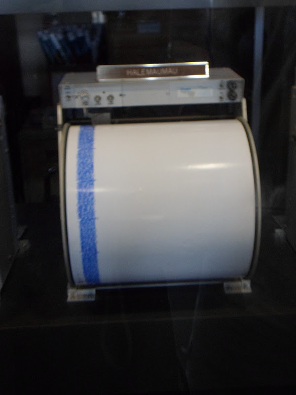
  Inside we saw exhibits on lava and seismic monitoring.


We grabbed a quick lunch there then went into the HVO.  This is the place to be if you LOVE Volcanology!!


Thermal Imaging

Picture of flowing lava
We explored all the rooms, so much to see, then we decided it was time to go for a hike.  Side note..We probably would have driver the Crater Rim drive but the road was closed at the Museum due to high amounts of sulfur dioxide gas. 
We drove to the Thurston Lava Tube near the Kilauea Iki Overlook.  We walked through lush rain forest until we came upon the 500 year old lava tube.  Lava tubes are formed when active lave flow develops a continuous and hard crust which thickens and forms a roof above the flowing lava.  It can be active or extinct.  After the lava ceases to flow, the rock cools and a cave like channel is created.  The Thurston Lava tube was almost a half a mile long.


Time for the big hike.  Kilauea Iki.  It is described as follows:  Descend 400 feet through native rain forest into a crater and hike across the hardened lave lake still steaming from the 1959 eruption.  Spectacular views, 2-3 hours, 4 mile loop trail.
So you may be asking, what about the gases from the Halema'uma'a Crater?  The best way to describe the location of where we are hiking compared to the erupting gases of the Crater is to look at this map.


The blue lines are the hike around the rim and down and over the crater floor.  The orange is where the Crater we viewed at the visitor center is sprewing gases.  Yes, that close.
Here is the view from the Kilauea Iki Crater Overlook.  We hiked to the right, then down just before that open area in the center, than across the crater floor and up the other side.


 If you look real close, there are people on the whiteish line on the crater floor.
The dirt path lead along the rim (had to look down as you walked to watch for roots and stones so as not to trip and go for a really big fall), with, as they said, spectacular views.  Scott was a little nervous that whenever there was a lookout or a bench to sit and enjoy the view, there wasn't any kind of guard rail.  Rock wall pretty much straight down.  We did not see any small children on this path thank goodness, and actually not that many people attempted the hike, which made it even more exciting!  Eventually the path turned into a switchback with some stairs as it descended down to the crater floor. 


View of Crater from path


It is hard to describe what the crater floor looked like..black, lava everywhere.  Where do we go now?  No noticeable path in the lava but then we saw this sign.


 We walked over cracks in the lava floor and pass the Pu'u Puali cinder cone.


A view back


This whole hike was so, so cool!  If you are at this park, and are able to hike for 2/3 hours, take this hike!  If you can't hike it, go to the Kilauea Iki Overlook, to see the view its amazing.

For a shorter hike there is the half mile Devastation Trail, where you see life returning to an area where the landscape was buried by cinders from the 59 Kilauea Iki eruption.

Can lava be actually seen anywhere?  I wondered about this because I noticed the information sheet and map we were give at the visitor center is not updated daily and the information listed for the Chain of Craters road (19 miles from summit rim and ends at 2003 lave flow) is probably not current.  It says that if you take this road during the day you might see fumes on the hillside or steam clouds at the ocean.  Sometimes after dark flowing lava may be visible in the distance from the road.  It said that the trail to the overlook is open 24 hours a day, wear sturdy hiking shoes and take water.  This sheet was printed in December 2011.

So then I checked with the daily Volcano watch online.  It states that you can not see flowing lava at the current ending of the Chain of Crater road and hiking to Ka'ili'ili area (overlook) is extremely arduous, with uneven, jagged and sharp lava.  All skin must be covered with several other precautions listed.
The past 24 hours: overall eruption was slightly elevated.  Seismic tremors levels indicate 10 earthquakes took place in and beneath the Kilauea volcano.  This shows just how much things have changed in just a couple months, and I don't think its advisable to try and see the lava.


I found this interesting..
Here is a map that shows the lava flow from 1983 to January 2012.


Lava Flow
1983-1986 dark gray              
86-92 pale yellow
92-2007 tan            
2007-2011 pale orange
eruption March 2011 reddish orange
Mar 2011 - Aug 2011 orange
Sept 21, 2011 - Jan 12, 2012 pink
Jan 12, 2012 - Jan 26, 2012 bright red
Yellow is the lava tube within the active flow.


Normal Park entrance fee is $10.00 per car and the park is open 24 hours.


To Be Continued..

Wednesday, February 1, 2012

Hawaii, the Big Island

Scott and I recently visited the big island of Hawaii..  This was our third trip to the islands; two previous trips to Oahu and one trip to Maui.  We were gone ten days, and had a fantastic time finding so much to do and see.  We were extremely lucky to stay with Lynn and Mike in their beautiful new Kona hillside home.   Kona is on the western side of the island, home to the Iron Man Triathlon, and overlooks the Kona coast.  Being located on the hillside means stable slightly cooler temperatures than at sea level, dry air and a fantastic view.  When we were there temperatures were in the mid to upper 70s everyday compared to at the ocean front where it was in the mid to upper 80s, and it hadn't rained in two months (but did rain one night we were there).  There is a vog (sulfur dioxide and other gasses emitted by an erupting volcano react with oxygen and moisture in the presence of sunlight...volcanic & smug = vog) that appears over the top of the Huualalai volcano (8,271)  which is just east of Kona.  It floats over Kona usually in the afternoon, shielding some of  the heat of the sun.  Sometimes you can only see it from a distance, what I mean is, you don't know you are in it, but when you are at the ocean and you look up, you see it covering the hillside.


This was our starting point for all our adventures.  Rather than to blog day by day I am going to share our experiences by topics or excursions.  Come along on our visit to paradise.

Hawaii, the largest of the Hawaiian islands has amazingly different topography and geography.  Lush green rain forests, dry deserts to the north, rolling pastures, familiar deciduous plants, sunny sandy beaches, angry and sleeping volcanoes, and lava, lava, lava everywhere.  We traveled to all points, north, south, east, west.  Put on over 1100 miles and always enjoyed the view.

Lets start with Hilo.  We traveled east to Hilo on a clear and sunny day, over the center of the state by the Saddle Road.  This road started out as a desert as we traveled alongside the Mauna Kea Volcano, then became deciduous, then as we neared Hilo it became a rain forest.  There is more rain on the east side of the island, thus the lush greenery.


View of a couple of Mauna Kea's observatories.


We visited the Pacific Tsunami Museum in downtown Hilo.  This museum has interactive exhibits, lots of pictures from turn of the century Hilo, and a film of survivors stories from the '46 Tsunami that flooded the downtown area killing 159 people.   The main story was in 1946 as the Tsunami was building, water resided, people ran onto the ocean floor to collect fish, then the Tsunami hit.   All was very informational, and it was interesting to see how the area looked in 1946 and how the downtown area was rebuilt.  More open land and parks along the ocean rather than residential homes.  Admission cost $8.00 adults; $4.00 children 6-17.
Hilo

After a quick lunch we traveled 5 miles south of Hilo on Hwy 11 to the Mauna Loa Macadamia Nut Corporation.  After a 3 mile drive along rows and rows of Macadamia trees (250,000 trees in the orchard) we came to the visitors center.  There is a self walking tour with videos that explains how the nuts are cracked, processed, canned and shipped everywhere in the United States.  During the week you can view the assembly line workers in the factory (we watched them hand place each nut in the center of a piece of dough.).  Then we went into the store and sampled plain, chocolate covered, and toffee covered mac nuts (as much as we wanted).  We then purchase some to take back to Lynn and Mike, a few gifts, and a bag for ourselves.  The store was filled with people and we saw a individual from a Japanese tour group purchase what turned out to be two huge bags of nuts, well over $100.00.


We truly enjoyed the two places we visited but overall were not excited about the city of Hilo itself.  It does have a nice bay which boasts a Japanese garden though we did not stop to walk it, but I did take a picture.

We then headed north through Hilo and along the coastline, then through the small town of Honomu to the Akaka State Park.   There is a parking fee of $5.00 to park and then hike.   The path is a half mile through dense vegetation that leads to two waterfalls.

Scott by some bamboo
   Kahuna Falls dropping 300 feet and a little further on Akaka Falls.


straight fall of 442 feet
                                                       

We continued along the Hamakua coastline then inland and back to Koni.  Perfectly clear all day!

To Be Continued...